


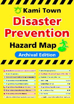
Kami Town Disaster Prevention Hazard Map(加美町防災ハザードマップ【英語版】)
In recent years, a series of disasters, such as large-scale earthquakes, heavy rainfall, sediment disasters caused by major tyhoons, and overflowing rivers, have caused great damege throughout the country, including the loss of precious lives.
Kami Town has produced "Kami Town Disaster Prevention Hazard Map" to inform the public of the newly announced flood hazard zones of the Nabuta River, Mujinasawa Reservoir No.2, and Nagiriya Reservoir in preparation for large-scale natural disasters.
We advise all residents to be prepared for any emergency, to know the disaster risks in their town, and use this map in their daily disaster control measures.
Kami Town Disaster Prevention Hazard Map
Kami Town Disaster Prevention Hazard Map (Full page) (PDFファイル: 18.6MB)
Page2 Disaster Preparedness (JPEG: 3.6MB)
Page3 5 Alert Levels, How to Obtain Disaster Management Information (JPEG: 4.0MB)
Page4 Tings to Know About Wind Disasters (JPEG: 5.6MB)
Page5 Tings to Know About Water Disasters (JPEG: 3.5MB)
Page6 Tings to Know About Sediment Disasters (JPEG: 5.7MB)
Page7 Tings to Know About Earthquake Disasters (JPEG: 4.2MB)
Page8 Tings to Know About Fire Disasters (JPEG: 4.1MB)
Page10 List of Emergency Shelters (JPEG: 3.9MB)
Page11 Your Disaster Prevention Measures & Check List (JPEG: 4.2MB)
Page12 Stockpiles & Emergency Provisions (JPEG: 4.0MB)
page13&14 Kami Town Overall Map (JPEG: 4.1MB)
Page15&16 Detailed Maps 1 (JPEG: 4.6MB)
Page17&18 Detailed Maps 2 (JPEG: 4.7MB)
Page19&20 Detailed Maps 3 (JPEG: 4.6MB)
Page21&22 Detailed Maps 4 (JPEG: 4.0MB)
Page23&24 Detailed Maps 5 (JPEG: 4.1MB)
Page25&26 Detailed Maps 6 (JPEG: 4.4MB)
Page27&28 Detailed Maps 7 (JPEG: 4.5MB)
Page29&30 Detailed Maps 8 (JPEG: 4.1MB)
Page31&32 Detailed Maps 9 (JPEG: 4.6MB)
Page33&34 Detailed Maps 10 (JPEG: 4.2MB)
Page35&36 Detailed Maps 11 (JPEG: 4.1MB)
Page37&38 Detailed Maps 12 (JPEG: 4.5MB)
Page39&40 Detailed Maps 13 (JPEG: 5.0MB)
Page41&42 Detailed Maps 14 (JPEG: 5.9MB)
Page43&44 Detailed Maps 15 (JPEG: 3.5MB)
Page45&46 Detailed Maps 16 (JPEG: 3.9MB)
Page47&48 Detailed Maps 17 (JPEG: 5.3MB)
Page49 Tings to Know About Reservoirs (JPEG: 3.5MB)
Page50 Reservoir Hazard Map 1 (JPEG: 8.4MB)
Page51&52 Reservoir Hazard Map 2 (JPEG: 5.2MB)
Page53 My Timeline (JPEG: 3.6MB)
Page54 My Timeline (JPEG: 3.6MB)
Back Cover Our Family`s Emergency Preparedness Notes (JPEG: 2.6MB)
Helpful Apps and Websites in the Event of Disaster(災害時に便利なアプリとWEBサイト)
Accurete collection of information is impotant in disaster.In the Website of the Cabinet Office disaster prevention, you can download multilingual leaflets that introduce smartphone apps and websites providing information about disasters in Japan.
災害時は正確な情報の収集が大切です。内閣府防災情報のページでは、日本の災害情報などを知ることができる、スマートフォンのアプリとWEBサイトを紹介する多言語のリーフレットをダウンロードすることができます。

※Supported language
Japanese,English,Chinese(Simplified/Treditional),Korean,Spanish,Portuguese,Vietnamese,Thai,
Indonesian,Tagalog,Nepali,Khmer,Burmese,Mongolian
※対応言語
日本語,英語,中国語(簡体字/繁体字),韓国語,スペイン語,ポルトガル語,ベトナム語,タイ語,インドネシア語,タガログ語,ネパール語,クメール語,ビルマ語,モンゴル語
この記事に関するお問い合わせ先
加美町危機対策課
〒981-4292
宮城県加美郡加美町字西田三番5番地
電話番号 0229-63-5264
ファックス番号 0229-63-2037
お問い合わせフォームはこちら
更新日:2023年02月13日